3D map of downtown San Diego!

How many countries or states (confusion & denial don't count) have you been to?

Dumps of Unusual Size 145: Wallpapers - Maps, Part Twelve

Dumps of Unusual Size 144: Wallpapers - Maps, Part Eleven

Dumps of Unusual Size 14: Wallpapers - Maps, Part Ten

Map of Indigenous American nations, c.1500s (Public domain, copyright-free)

Dumps of Unusual Size 142: Wallpapers - Maps, Part Nine

Dumps of Unusual Size 141: Wallpapers - Maps, Part Eight

Dumps of Unusual Size 140: Wallpapers - Maps, Part Seven

Dumps of Unusual Size 138: Wallpapers - Maps, Part Five

Dumps of Unusual Size 137: Wallpapers - Maps, Part Four

Dumps of Unusual Size 135: Wallpapers - Maps, Part Two

Dumps of Unusual Size 124: Wallpapers - Maps, Part One

Physiographic provinces of Maryland

Dumps of Unusual Size 125: Wallpapers - A Song of Ice and Fire

European population per capita

Dumps of Unusual Size 136: Wallpapers - Maps, Part Three

Dumps of Unusual Size 139: Wallpapers - Maps, Part Six

Nothing to see here...

The Scale ranges from 0 to 2, and everywhere in the US scored below 1.

Das Deutsche Reich
Geographically simplified.
WTF Is this?

Traditional Paintings

Imperial Armour - Major Stellar Maps

US counties I've visited as of July 2025. I've hit all 48 contiguous states plus Alaska. Hawaii here I come!

Administrative Map of the German Middle Africa (Deutsch-Mittelafrika), circa 1921

In no particular order here are the different factions of the right wing

[OC] Detailed map of Antarctica with its active research stations and its main physical features [4494x3178]

D

15-Foot World Map in Kids' Room -- Favourite Shots

[OC] Detailed map of the Arctic with its main cities, physical features, connections, and sites of interest [4494x3178]
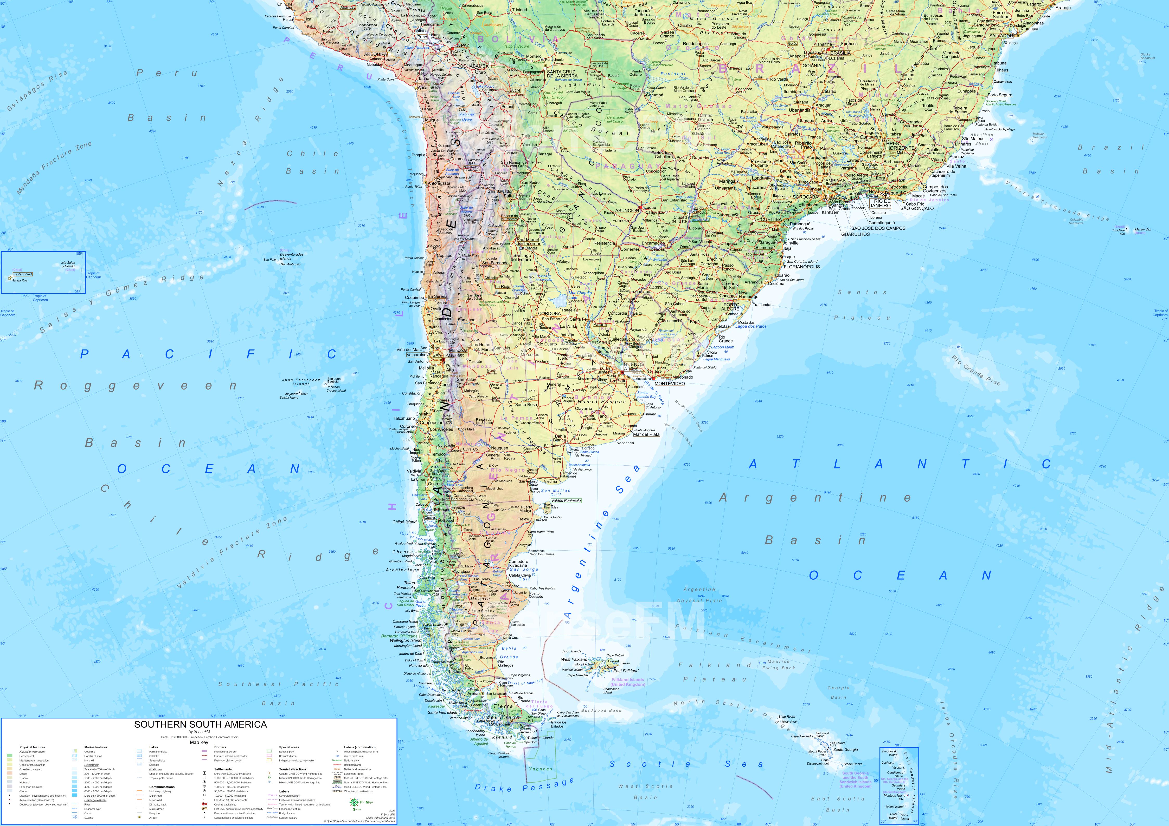
[OC] Detailed map of southern South America with the main cities, physical features, connections, and sites of interest [4494x3178]

[OC] Detailed map of northern South America with the main cities, physical features, connections, and sites of interest [4494x3178]

I do love me some maps.

[OC] Detailed map of southern North America with the main cities, physical features, connections, and sites of interest [4494x3178]

Terminator: Post time-travel Timeline by Arcticboi1458

[OC] Detailed map of northern North America (Canada and Alaska) with the main cities, physical features, connections, and sites of interest [4494x3178]

0, 100, 100, 0

Map of Tschai

[OC] Detailed map of Southern Africa with the main cities, physical features, connections, and sites of interest [4494x3178]

España Napoleónica - ambiciones y propuestas

U.S. Geography simplified

Why ?

[OC] Detailed map of northern Africa with the main cities, physical features, connections, and sites of interest [4494x3178]

A map by Collin Woodard showing the nations of america.

[OC] Detailed map of Southern Oceania [4494x3178]

14 or so Annotated Maps on Map Design

1957 Hand drawn map of the Atlantic Ocean by Marie Tharp. Very large file, zoom in

[OC] Detailed map of northern Oceania [4494x3178]

[OC] Detailed map of Australia and New Zealand with their main cities, physical features, connections, and sites of interest [4494x3178]

[OC] Detailed map of Southeast Asia with its main cities, physical features, connections, and sites of interest [4494x3178]

Tea Mountains of China and how to reach them

[OC] Detailed map of East Asia with its main cities, physical features, connections, and sites of interest [4494x3178]

The Mystery of Hayti, Mississippi

Detailed map of southwestern Asia (Middle East+South Asia) with its main cities, physical features, connections, and sites of interest [4494x3178]

Administrative Map of German East Asia (Deutsch-Ostasien), circa 1921

We need to adjust the electoral college and representation models

Detailed map of northern Asia with its main cities, connections, and sites of interest [4494x3178]
Page 1
Next page